INTEGRATION VIEWER – OFF-LINE or ON-LINE
DESKTOP or WINDOWS TABLETS
C/C++ SDK
SERVER ACCESS MODULE
vieWTerra Evolution 4D real-time Earth Viewer: Introduction
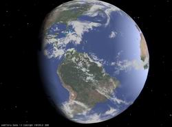
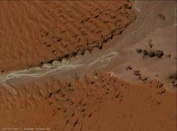
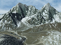
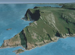
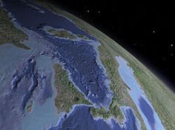
The vieWTerra Evolution Viewer allows seamless navigation around a 3D real-time ellipsoidal model of the Earth, zooming in and out without loading times and with a total freedom of movement in every direction from the bottom of the seas to outer space. It therefore also allows travel in Space beyond the stratosphere, the Earth being set in a solar system comprising the Sun, Moon and Mars bodies, and the stars in the vault of heaven. On Earth, it distinguishes itself by a strikingly realistic rendering of all the landscapes around the Globe, offering both far-away horizons and close-up precision, down to the blade of grass.
To that aim, it makes use of various Digital Elevation Models, Imagery, Land Cover, Ecoregions and Weather databases as well as other types of datasets.
Being a 4D system, it takes in account the time (T) dimension in order to allow for continuous time of day and seasonal changes, dynamic rendering of all types of weather conditions or dynamic scenario creation and replay.
As definition for its Earth model, the vieWTerra Evolution Viewer today offers, worldwide or per area of the World, the vieWTerra Base set of global true colour and cloud–free 15m Imagery (resampled to 29m in vieWTerra format), 90m DEM and 29m Land Cover mosaics, while also including much more precise data in certain areas of the World as an example of integration:
20 million km² are currently covered in higher resolution (10 m to 45 cm for Imagery, up to 30 m, 3,60 m for DEM).
User integration of Imagery, DEM and Land Cover data up to 45 cm resolution is currently supported.
The vieWTerra Evolution Viewer also renders the worldwide hydrographic network, and the global undersea topography (928m resolution resampled to 90m). It makes use of worldwide flora and fauna distribution databases as well.
Users can integrate more accurate data in multiresolution format on their own, including GeoTIFF, DTED or shapefile formats, LiDAR or photogrammetry-acquired high definition Objects and DEM models (3D Terrain Objects) and/or access WMS-WMTS raster data streams. Users can also very easily complete or correct the information from the Imagery or the Land Cover via the Editor Tool, which is embedded in the Viewer (accessible through the Edit Window), and allows real-time modifications directly into the 3D (e.g. fill riverbeds with water to complete a river, add or remove trees, place or erect buildings at their real-world location, etc.).
Additional geotagged assets such as photos, videos, audio recordings, PDF documents, graphs, etc can easily be integrated under actionable 2D windows form, accessible from information stacks.
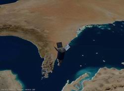
The vieWTerra Evolution Viewer includes various controls in its User Interface, so that users may conveniently and in real-time change the various parameters in the 3D Window: time of year, time of day (triggering dynamic lights and shadows), temperatures, wind speed and direction, precipitations, snow cover and visibility (changing the type of weather, or the height or range of the snow mantle in real-time). It also already includes a set of dynamic entities (from pedestrian avatar to the space shuttle for instance), which can be controlled in real-time by the user, and either incarnated in 1st person mode or viewed from the outside by using 3rd person cameras from any possible angle.
Users can very quickly and easily implement their own scenarios, by customizing the scenery thanks to the Editor Tool and its Bank of 3D Objects, and by animating the scenes via the various controls of the User Interface. They may also integrate their own 3D objects via the Entity Tool, embedded into the Viewer, or via the vieWTerra Evolution SDK. New dynamic entities can easily be integrated, these entities can be either controlled in real-time by the user, by a CVS trajectory file or remotely by UDP protocol.
A great variety of scenes anywhere/anytime across the entire surface of the Earth, and beyond, can therefore be created, modified, recorded, replayed and studied at will, as users can go backward and forward in time to record and edit videos.
The vieWTerra Evolution Viewer, at a glance:
• seamless rendering of the entire surface of Planet Earth, from the seabeds to the stratosphere and beyond (the Earth being a 3D ellipsoid with its correct radius, axial tilt, and flattened poles, and the Sun, Moon and Mars bodies and the stars being represented at their correct locations)
• extra-terrestrial navigation, instant travel mode to the represented astronomical bodies
• procedural rendering system allowing 1cm procedurally-generated detail at the ground level, both for geometry and texture maps
• whole Earth database provided: 90m global DEM, 29m global Land Cover, 29m Imagery for 1 or more areas of the World depending on License chosen (default worldwide Imagery for other areas supplied at 232m)
• undersea DEM database (928m) and water surface database (29m) provided, including all seas, main rivers and lakes
• meteorological databases (cloud cover, temperatures, precipitations, wind) based on weekly and monthly average data (year 2005 used as a template year of reference)
• real-time simulation of
weather conditions changes including volumetric clouds, mist, fog, rain with puddles, storms with thunder and lightning, variable snow cover, etc.
• 3D sea: changeable water colour, actionable shaders, wave patterns, water transparency and sun reflection; global sea level rise, local tides
• dynamic management of
natural and artificial lights system including a rendering of dynamic shadows based on raycasting algorithms (based on the Earth’s rotation and its revolution around the Sun) and taking into account materials to present a different rendering according to the degree of reflection/refraction to light
• dynamic vegetation rendering system based on Land Cover data and Ecoregions, allowing for the correct attribution and automatic planting of trees species and low vegetation around the entire Globe
• management of
Autonomous Life Form (ALFs), in order to populate the world with billions of randomly animated animals or entities
• real-time scene building directly into the 3D Window thanks to the Editor Tool, for easy construction and shooting of scenes anytime/anywhere on the entire surface of the Earth. Painting and drawing fonctions supported, for easy and quick scene modifications; management of complex shapes using the Vertex Tool; also features the capability to create holes and excavate
• automatic integration of architectural elements to the ground (terraforming) and random texturing of buildings offering variations in colour/ size/ orientation, etc to obtain a greater visual variety
• auto-extrusion of entire real-world cities based on footprint data (georeferenced location and height of buildings), in a couple of minutes only
• easy-to-use Texture Editor Tool for draping of textures (e.g. photos) over each building’s façade to as to get mirror 3D representations of each real-world façade
• alternative integration of Lidar or photogrammetry-acquired datasets for buildings & terrain models. Generation of new elevation datasets based on these high-definition Terrain Objects.
• GIS tools: a collection of high-performance measuring tools including distance, height, surface, profile and horizon (360° line of sight). Drawing of 3D lines on the surface, Terrain Objects, 3D Objects and exporting these as shapefiles. Creating camera-controlled trajectories (to define e.g. evacuation routes, fieldtrips)
• visualization and fusion of large amounts of 2D and 3D data: multilayer display system, offering also transparency management:
- switch on/off additional information such as place names, frontiers, geospatial icons
- access complementary on-line supplied WMS-WMTS data streams (e.g. Open Geospatial Consortium source: worldwide cartography, Imagery, flight routes, etc)
- add custom pins, labels, shapefiles, csv files and GeoTIFF files draped as layers
- share these integrated data and assets between multiple users with the On-Line License
- display of terrain/scene modifications applied by each user, visible by all users in On-Line mode
• 5 million+ geographic feature names directory including national parks, mountain peaks, lakes, etc. in each country’s language
• adding own Information stacks capability: anywhere on the Globe at user's chosen coordinates:
- click on the stacks to open your integrated attached information under actionable 2D windows (videos, audio recordings, photographs, PDF documents, graphs, etc);
- view these locally on your PC only or uploaded and shared on-line with any and all selected users depending on chosen user's rights
• geo-referencing of photos/videos and possibility of overlaying photos instead of, or blended with, the 3D rendering and overlaying videos
• creation of static or dynamic entities in vieWTerra-optimized proprietary format: conversion from most formats via the Entity Tool directly into the Viewer, or via the vieWTerra Evolution SDK; depending on its nature, each new entity can then be added into the vieWTerra Evolution Bank of Objects or included among the user-controllable entities
• import of new dynamic user-controllable entities. These entities can either be controlled by the user, by a CVS trajectory file or remotely by UDP protocol or equivalent
• collision and environment query system, each entity being informed of its environment
• special effects management system: fire, smoke, trails, tracks, lighting, etc
• rendering of objects according to their materials (glass, wood, metal, etc), taking into account reflection/refraction to light
• multi-screen rendering; active/passive stereo view; 3D sound system
• multi-users on-line data & assets database sharing system:
Sharing of one or several Integrator Users's datasets and assets with a pool of corporate Viewer-users using a vieWTerra Evolution On-Line License, upload on the client server being ensured via the vieWTerra Access server access module
Optional module to the vieWTerra Evolution Viewer or Platform License:
On-the-fly visualization of sensor-acquired Imagery data, direct ortho-rectification of Imagery data by the software itself (no mandatory import of previously orthorectified datasets). Accurate measuring through the sensor acquisition cone and visualization of its footprint ensured by accurate ray-casting algorithms.
vieWTerra Evolution SDK/Library
Advanced users are also being given access to C/C++ VWorldTerrain© technology library so that they may freely modify certain parameters and create import/export plug-ins for their own datasets. For instance users can freely access functions allowing to modify time, meteorological conditions, rendering, FXs, sounds, or enhance the entities' AI and physics, add custom trajectories or communications signals, etc so that the subsequent runtimes would be tailored to their specific needs.
- C/C++ library, Windows XP/Vista OpenGL/Windows 7 and above
- 700+ functions
- Viewer source code samples provided
- high level programming capabilities (e.g. integration and movement of 3D entities, special effects)
- low level programming capabilities (e.g. 3D and 2D drawing functions, callback functions)
vieWTerra Access
vieWTerra Access is the server access module coming along vieWTerra Evolution On-Line License.
It is comprising the following items:
• The vieWTerra database: the common database holding all uploaded datasets and assets or constructed scenes, forming the whole vieWTerra World. The vieWTerra database allows quite practical and near real-time terrain paging, just by uploading datasets and assets; as it is not a relational database, it is not versioning dependent and therefore does not require maintenance or costly tools.
• The Access Management database
• The Back-Office: communicates with the Access Management database and allows organisations to define and control user accesses: add users, define user rights, etc.
• The Server Set-up Assistance in order to install your own vieWTerra server
Users can connect to their own vieWTerra server to upload or view data using vieWTerra Evolution On-Line. Uploading is a simple and time-efficient process. This allows several co-workers to work together on the same projects while sharing and consulting information through the server(s), even if they are physically on the other side of the Planet. Multiple users can therefore be given access to only consult selected portions of data or the entire database of uploaded datasets and assets.
Client's organisation remains in complete control of its server administration. Editing and uploading data requires a workstation with a vieWTerra Evolution On-Line license.
vieWTerra Mobile users can also connect to a vieWTerra server in a viewing capacity only.
